 1 / 3
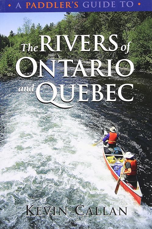
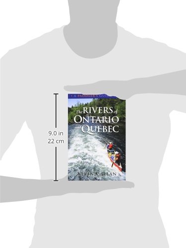
A Paddler's Guide to the Rivers of Ontario and Quebec
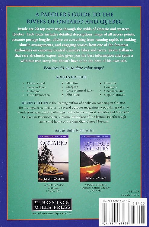
A Paddler's Guide to the Rivers of Ontario and Quebec presents 20 river trips, with route descriptions and maps intended to show access points, river features and portage lengths. It suits canoeists planning routes in Central Canada, though the supplied details do not identify when the routes or maps were last updated.
At a glance
- Route descriptions are paired with maps that the listing says show access points, river features and portage lengths.
- The listed routes span Ontario and Quebec, with examples including the Rideau Canal, Mattawa, Mississagi and Dumoine.
Often bought together

Pros and cons
Pros
- Combines route descriptions with maps and practical route details such as access points and portage lengths.
- Covers a range of named river trips across two provinces.
Technical specifications
11 specifications| Publisher | Boston Mills Press |
|---|---|
| Publication date | Feb. 1 2003 |
| Edition | Revised and updated |
| Language | English |
| Print length | 168 pages |
| ISBN-10 | 155046387X |
|---|---|
| ISBN-13 | 978-1550463873 |
| Weight listed | 363 g |
|---|---|
| Dimensions | 15.24 x 1.27 x 22.86 cm |
| Trips described | Twenty top river trips through the wilds of Ontario and Quebec. |
|---|---|
| Example routes | Rideau Canal Saugeen River Oxtongue Little Bonnechere Mattawa Sturgeon West Montreal River Mississagi Dumoine Coulonge Chochocouane Upper Gatineau |
What to know before buying
- The book was published in 2003, so route access, conditions and map details may need current confirmation before a trip. The listing does not specify the maps' scale or when they were last updated.
Who is it for?
A good fit for
- Canoeists planning river trips in Ontario or Quebec who want route descriptions and mapped access information.
- Readers looking for a printed collection of multiple Central Canadian river itineraries.
Less suited to
- Anyone seeking confirmed current access conditions or recently updated route maps, as the listed publication date is 2003.
Customer reviews on Amazon
- 5 stars
67% 67% - 4 stars
24% 24% - 3 stars
9% 9% - 2 stars
0% 0% - 1 star
0% 0%
Aggregate ratings lean positive, with most ratings in the four- or five-star categories and some three-star ratings. That offers a broadly favourable but not unanimous signal, and the available information gives no specific customer comments or reasons. Buyers should judge the book by its stated coverage and consider the 2003 publication date when relying on route details.
Frequently asked questions
What areas does the guide cover?
It describes river trips in Ontario and Quebec. Named examples include the Rideau Canal, Mattawa, Mississagi and Dumoine.
What information do the maps provide?
The listing says they show access points, important river features and portage lengths.
Is this a recently published guide?
The listed publication date is Feb. 1 2003. Check current access and route conditions before relying on it for trip planning.
Alternative options
Venice Travel Puzzle Book: 50 Brain Games, Trivia & Things to Do for Adults | Local History, Landmarks, Hidden Tips & Culinary Secrets | The Perfect Companion for Your City Trip
$24.95
A Paddler's Guide to Killarney and the French River
$24.47
Gaspé the Romantique 'Revisited': A Road Trip Guide to the History, Legends and Attractions
$34.95
THE PORTUGAL TRAVEL HANDBOOK: DISCOVERING THE HIDDEN GEMS, EMBRACE THE CULTURE AND EFFECTIVELY BUDGET
$28.84
Canoe Atlas of the Little North
$80.70
Ireland Travel Guide: Explore Dublin, Galway, Cork & Beyond with Local Tips | Taste Irish Food, Discover Castles and Scenic Routes with Digital Maps, Cultural Insights & Travel Experiences
$14.69