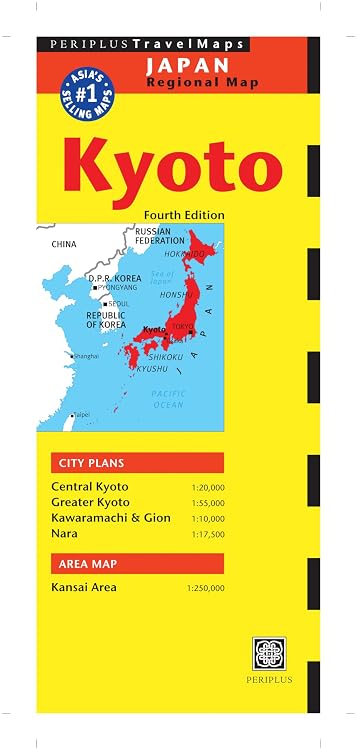
Periplus Kyoto Travel Map, Fourth Edition
Fourth Edition: Periplus Kyoto Travel Map is a foldable paper map covering Kyoto and nearby areas, with city plans at several scales and a Kansai area map. Its coated paper is described as suitable for repeated opening and folding, while the 2013 publication date is worth weighing if you need current travel information.
At a glance
- Multiple scales cover central and greater Kyoto, Kawaramachi and Gion, Nara, and the wider Kansai area.
- The listing describes coated paper designed to open and fold repeatedly.
- The map is intended to help locate destinations including hotels, gardens, museums, restaurants, and temples.
Reference price: $12.95
Price checked: Nov 19, 2026
View offerAhead of Black FridayExplore the selectionOften bought together
Pros and cons
Pros
- Combines detailed city plans with a broader Kansai-area map in one printed map product.
- Separate scales give buyers more than one level of geographic detail for trip planning.
Cons
- A printed map cannot reflect changes made after publication, so it may be unsuitable as the sole source for current routes or businesses.
Technical specifications
13 specifications| Publisher | Tuttle Publishing |
|---|---|
| Publication date | Oct. 22 2013 |
| Edition | 4th Revised ed. |
| Language | English |
| Print length | 144 pages |
| Central Kyoto | 1:20,000 |
|---|---|
| Greater Kyoto | 1:55,000 |
| Kawaramachi & Gion | 1:10,000 |
| Paper | durable coated paper |
|---|---|
| Weight listed | 1.05 kg |
| Dimensions | 10.8 x 1.02 x 26.04 cm |
| ISBN-10 | 4805311851 |
|---|---|
| ISBN-13 | 978-4805311851 |
What to know before buying
- The listing describes this as the Fourth Edition and gives a 2013 publication date, so confirm that its coverage suits your trip and use a current source for information that may have changed.
Who is it for?
A good fit for
- Travellers who want a physical map with several Kyoto-area scales and a Kansai overview.
- Visitors who prefer browsing a printed map for landmarks and local destinations.
Less suited to
- Travellers who need live routing or guaranteed current business and transport information.
- Readers looking for a guide focused on narrative recommendations rather than maps.
Customer reviews on Amazon
- 5 stars
64% 64% - 4 stars
22% 22% - 3 stars
7% 7% - 2 stars
4% 4% - 1 star
3% 3%
Aggregate ratings lean positive overall, but ratings alone do not identify what customers liked or disliked. Treat them as a broad signal rather than evidence that the map is current or that its coverage suits a particular itinerary.
Frequently asked questions
What areas does this map cover?
The listing names Central Kyoto, Greater Kyoto, Kawaramachi and Gion, Nara, and the wider Kansai area.
What scales are listed?
Central Kyoto is 1:20,000, Greater Kyoto 1:55,000, Kawaramachi and Gion 1:10,000, Nara 1:17,500, and Kansai 1:250,000.
Is it designed to be folded repeatedly?
The description says it uses coated paper and is made to open and fold multiple times.
Is the information current?
The listed publication date is Oct. 22 2013. For routes, transport details, or businesses that may have changed, check a current source as well.
Alternative options

Lonely Planet Pocket Kyoto & Osaka 4 4th Ed.: Discover Twice the Region in Half the Time, Top Sights, Maps & Walking Tours, Covers Kinkaku-ji, Nishiki Market, Gion and more
$22.99

Lonely Planet The Travel Book 4 4th Ed.: Photographic Journey Through Every Country in the World, 680 Stunning Images, Handy A-Z Format, Beautiful Gift for Travel Lover
$53.00

Japan Travel Guide: Plan 7–21 Unforgettable Days in Tokyo, Kyoto, Osaka & Beyond with Stress-Free Transportation, Authentic Food, Local Culture & Essential Travel Tips
$16.97
Ireland Travel Guide: Explore the Emerald Isle from Dublin to Belfast with Local Tips, Hidden Gems, Detailed Maps, Ready-to-Use Itineraries, Best Eats & Stays, and Plan the Perfect Journey
$29.97

Japan Travel Guide: Plan Your Perfect Trip with Ready-to-Follow Itineraries, Train Travel Tips, Local Insights, Cultural Etiquette, Budget Advice, and Practical Planning Tools
$20.97

London Edition: 50 Puzzles & Challenges for US Travelers – Detailed History, Hidden Tips, Landmarks, and Culinary Secrets
$24.95

Italy Travel Guide: Captivating Adventures through Timeless Beauty, Art, Italian Landmarks, Hidden Gems, and More
$20.48
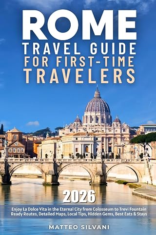
Rome Travel Guide for First-Time Travelers: Enjoy La Dolce Vita in the Eternal City from Colosseum to Trevi Fountain | Ready Routes, Detailed Maps, Local Tips, Hidden Gems, Best Eats & Stays
$26.97

Dublin Travel Guide: Captivating Adventures through Celtic Heritage, Pub Culture, Landmarks, Hidden Gems, and More
$19.09