 1 / 3
Lonely Planet Tasmania Planning Map, 2nd Edition
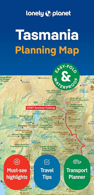
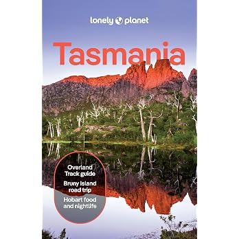
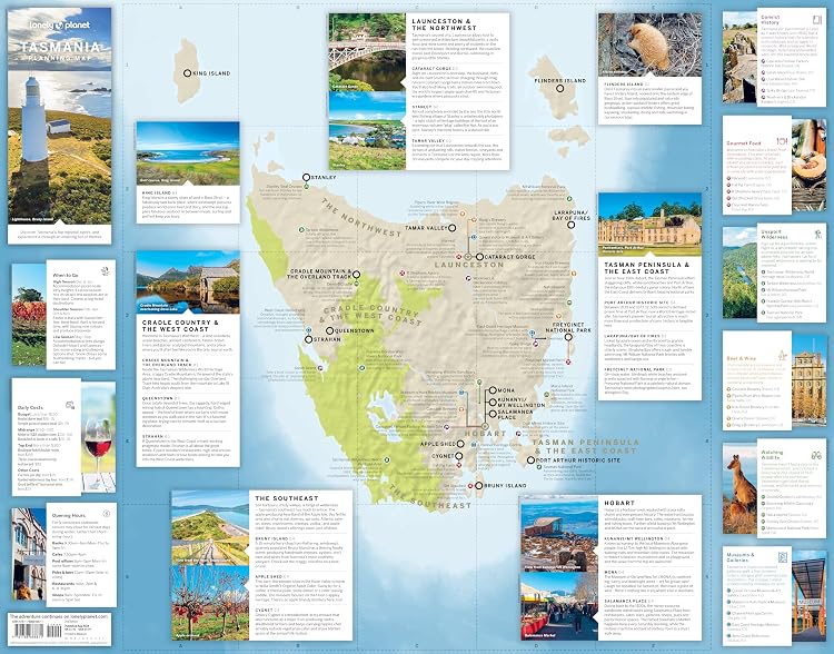
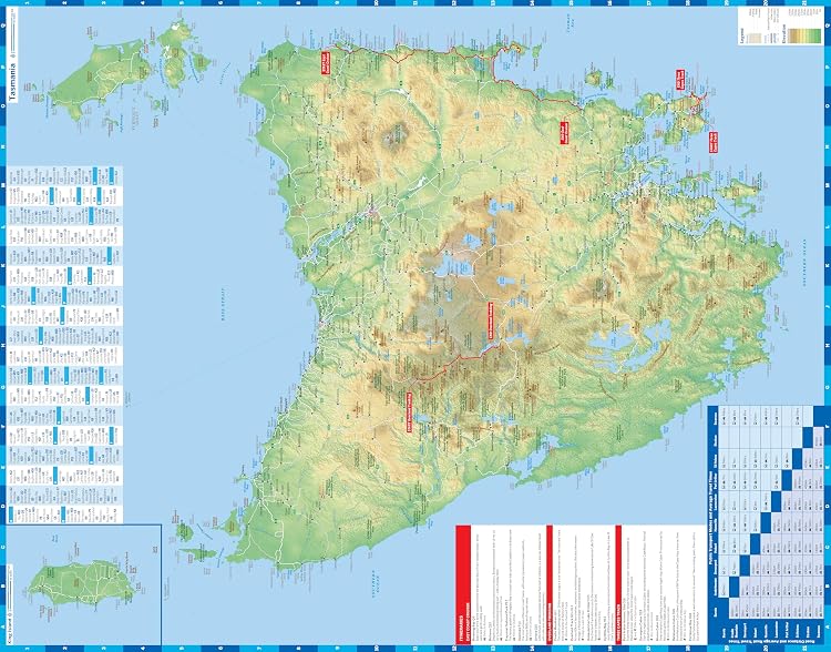
Edition: Lonely Planet Tasmania Planning Map is a foldable, full-colour map with travel-planning information for Tasmania, King Island and Flinders Island. Its town index, transport planner and itinerary suggestions add trip-planning context, while the slipcase is intended to make it easier to carry.
At a glance
- Covers Tasmania, King Island and Flinders Island.
- Pairs the map with a detailed town index and transport planner.
- Includes itinerary suggestions, regional highlights, themed lists and practical travel information.
- Listing describes the map as waterproof and supplied with a slipcase.
Often bought together
Pros and cons
Pros
- The town index and transport planner can help with route and destination planning without relying only on a regional overview.
- The compact folded format and slipcase are useful for carrying the map on a trip.
- The described coverage extends beyond Tasmania to King Island and Flinders Island.
Cons
- The listed print length is only 2 pages, so this is a map and planning aid rather than an extensive guidebook. The listing does not specify map scale or road-level detail.
Technical specifications
20 specifications| Publisher | Lonely Planet |
|---|---|
| Edition | 2nd |
| Publication date | Sept. 3 2024 |
| Language | English |
| Print length | 2 pages |
| ISBN-10 | 1788688872 |
| ISBN-13 | 978-1788688871 |
| Weight listed | 28.4 g |
|---|---|
| Dimensions | 9.65 x 0.64 x 19.69 cm |
| Places covered | CoversTasmania, King Island, Flinders Island |
|---|---|
| Map format | Easy-fold format and convenient size |
| Map colour | Full colour and easy to use |
| Protection and storage | Durable and waterproof |
| Included storage | Handy slipcase |
| Map reference | Detailed town index |
| Trip planning | Transport planner |
| Content | Tailored itineraries |
| Content | Can't-miss regional highlights |
| Content | Themed lists |
| Content | Before-you-go info |
What to know before buying
Listing details to confirm
The listing details are contradictory about the product's size: the title calls it a planning map, while the publication record gives a 2-page print length. Map scale and the level of road detail are unconfirmed, so check the selected edition's map coverage if those matter for navigation.
Who is it for?
A good fit for
- Travellers planning routes and stops across Tasmania, King Island or Flinders Island.
- Buyers who want a foldable paper map with an index and trip-planning prompts.
Less suited to
- Readers looking for extensive destination descriptions or an in-depth guidebook.
- Travellers who need a confirmed map scale or detailed road-level navigation before purchase.
Customer reviews on Amazon
- 5 stars
56% 56% - 4 stars
16% 16% - 3 stars
12% 12% - 2 stars
5% 5% - 1 star
11% 11%
Customer feedback describes the map as good quality and useful as a travel guide, while the aggregate ratings are positive overall but include a notable spread across lower star categories. That feedback may reassure buyers seeking a practical planning aid, but it does not establish map scale, road detail or waterproof performance.
Positive themes
- Customer feedback highlights map quality and usefulness for travellers.
Frequently asked questions
Which areas does the map cover?
The listing says it covers Tasmania, King Island and Flinders Island.
Does it include trip-planning information?
Yes. The listing describes a town index, transport planner, itinerary suggestions, regional highlights, themed lists and practical travel information.
Is the map waterproof?
The listing describes it as durable and waterproof. This is a seller or manufacturer claim, not an independently verified result.
Is this a detailed guidebook?
It is presented as a planning map, and the publication details list a print length of 2 pages. The listing does not confirm map scale or road-level detail.
Alternative options

Lonely Planet Epic Runs of the World 1st Ed.: Detailed Itineraries, Insider Tips, explore the world's most thrilling running routes and trails
$53.00
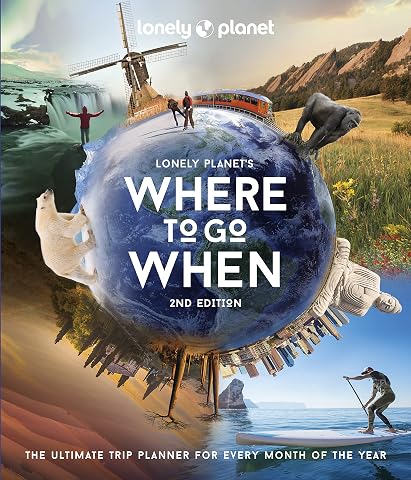
Lonely Planet's Where to Go When 2 2nd Ed.: The Ultimate Month-by-Month Travel Planner with 300+ Destinations
$37.99
Lonely Planet Where To Go When With Kids: 300 Family Travel Ideas, Month by Month Trip Planner, All Budgets & Seasons, Amazing Adventures for Kids, Teens & Adults
$55.98
Ontario Road Map Atlas for Seniors 2027: Detailed Provincial Highways, County, Regional & District Roads, Northern Ontario Wilderness Access, City-to-City Routes, Scenic Highways & Backroads
$12.99
Canada Road Trip Atlas 2027: Detailed Provincial & Regional Highway Maps with Trans-Canada Corridors, Canadian Rockies, Atlantic Coastal Roads, Northern Routes & Winter Navigation
$33.99
Canada Road Trip Atlas 2026–2027: Provincial, Territorial & Regional Maps with Trans-Canada Highway, Major Roads, Scenic & Coastal Routes, Northern Roads, Parks Access & RV Routes
$34.99
The Japan Know-It-All: 300+ fascinating facts about Japan, Tokyo, Anime, Manga, Japanese people, their culture, and everything else you need to know to understand Japan | Ideal Japan Travel Essential
$19.99
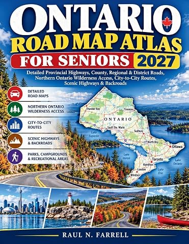
Ontario Road Map Atlas for Seniors 2027: Detailed Provincial Highways, County, Regional & District Roads, Northern Ontario Wilderness Access, City-to-City Routes, Scenic Highways & Backroads
$33.99
The Ultimate Travel Advent Calendar for Adults: 24 Inspiring Places to Fuel Your Next Adventure | Daily Travel Inspiration Until Christmas
$19.99